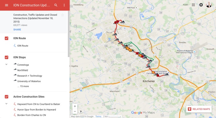
One of the problems with the Ion construction is that it is 14 kilometres long and you never quite know where you will hit a detour. It is frustrating and it has impacted my arrival time on many occasion. I have started avoiding the centre of town all together…but then I forget.
I happened across this map which is pretty cool. It really is amazing what we can do these days. How we live our lives is so different than a decade ago. I am in awe of the internet again and always.
The map not only shows the route and the stops (with a description of the stops), but also the active construction sites, the detours, the upcoming closures and the closed intersections. Very useful stuff.
With this, I should never be late again.